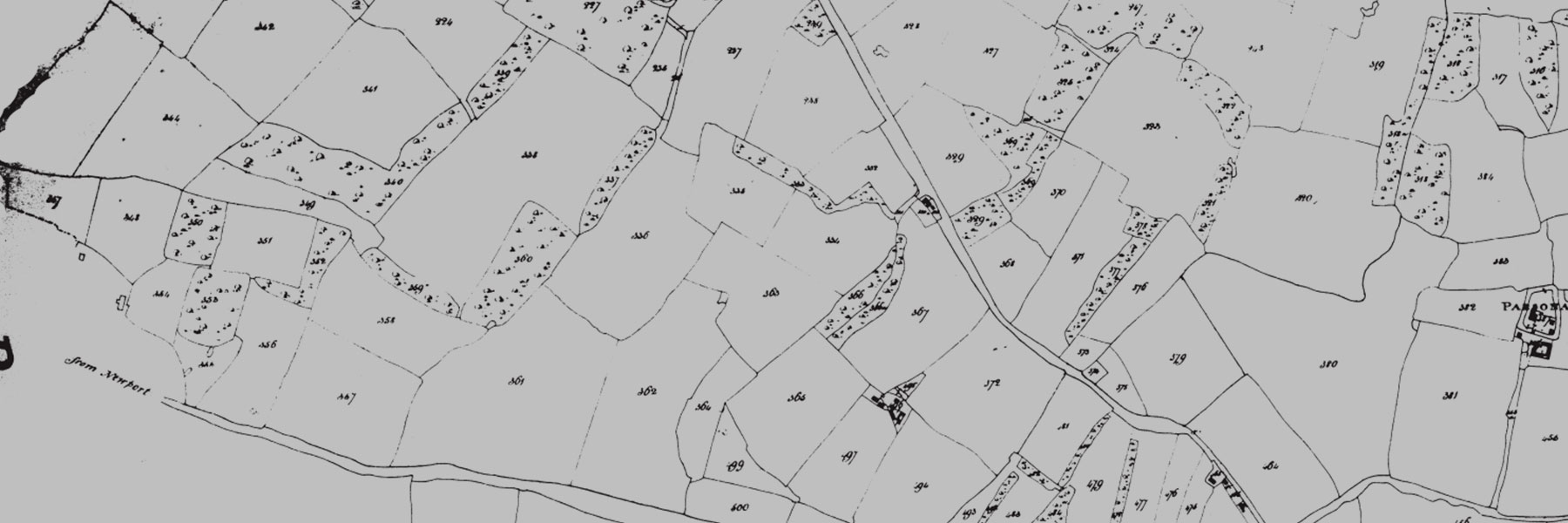
The 1840 Tithe map shows every field, wood, road track and house in Wimbish and was made in connection with the payment of tithes to the church which all land-owners had to make. Too big for a single sheet, the map is a 16-page printable booklet. The original is in the Essex Record Office together with the tithe roll which is hand-written and has now been transcribed. It lists the owners and tenants of every field and what the field was used for. This Excel file is easy to search for a field (if you know its name), the owner of a particular farm etc.